The baray lakes are ancient rectangular artificial reservoirs that are among the most remarkable highlights of Angkor. The 2 largest barays are on the east and west sides of Angkor Thom. The East Baray is 14 sq km large, and the West Baray is even larger at 16 sq km. Today, only the West Baray is still partially filled with water as is the moat around Angkor Wat. All other hydrological features of Angkor have dried up.
As to what actual purpose the barays served, some assume they were used for irrigation while others say they had religious purposes – there’s a stone temple called a mebon on an island in the middle of each lake. Regardless, they’re ancient engineering marvels.
- 1
East Baray

- 역사
- 사진
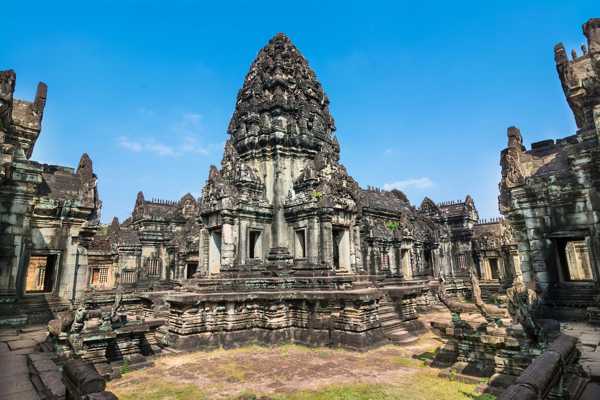
The East Baray is now dry and you can easily reach its mebon temple by vehicle. The East Mebon was the first temple constructed after King Rajendravarman II moved the capital back to Angkor from Koh Ker. It was built in the middle of the East Baray and is dedicated to the Hindu god Shiva.
The 3-level temple ruin is topped by 5 towers and features life-size stone elephants, each carved from a block of stone. Smaller statues line the stairways leading up to a central platform from where you can see the lake bed and rice fields in every direction. Records indicate there was activity here in as early as AD 947 but it wasn’t consecrated until AD 952.
주소: Siem Reap, Cambodia
지도 - 2
West Baray

- 역사
- 사진
The West Baray is 2 km wide and 8 km long and is partially filled with water. You can reach the West Mebon temple in the middle of the lake by boat. The temple ruins consist mostly of a wall with some carvings that depict animals in their natural habitats, similar to the reliefs at Baphuon.
There is speculation that the West Mebon may have originally held a famous bronze Buddha statue which is now in the National Museum in Phnom Penh. The West Baray has water in it year-round and is a popular recreation area. You can reach the West Baray off the National Highway No. 6, approximately 3 km past the airport turnoff.
주소: Siem Reap, Cambodia
지도사진 제공: MGA73bot2 (CC BY-SA 3.0) 수정됨


